OPTOkopter - Precise airflow measurements

OPTOkopters in flight
Flight path of the OPTOkopter in the measurement volume
Wind velocities in the measurement volume
Stream lines and wind velocities
The wind measurement of the OPTOkopter has been compared to the measurements of the wind lidar of the Physikalisch-Technische Bundesanstalt (PTB) - Germany's national metrology institute. The high resolution bistatic Doppler lidar is naturally free of any flow-distortion errors and determines the 3D wind vector.
Wind speed in 20 meters above ground level (time-resolved). Comparison with the PTB wind lidar reference. Due to buildings and trees in close proximity, the flow is very unsteady. However, the deviation from the PTB reference is very small.
Vertical wind direction in 20 meters above ground level (time-resolved). Comparison with the PTB wind lidar reference. The deviation from the reference is smaller than 1°.
OPTOkopter - a drone for measuring wind velocities
A wind reference station captures the temporal variation of the wind situation and improves the results.
Spatially and time resolved distribution of particulate matter. The embedded sensors measure the local distribution of air quality.
Example for a measurement plane directly behind a running wind energy plant. Time- and spatially-resolved flow velocities can be captured automatically. A synchronisation with the rotor blade position is possible.
Measurement of a reference wind velocity using a second drone
OPTOLUTION is working on developing tethered drones for non-stop measurements (power tethering).

The OPTOkopter drone

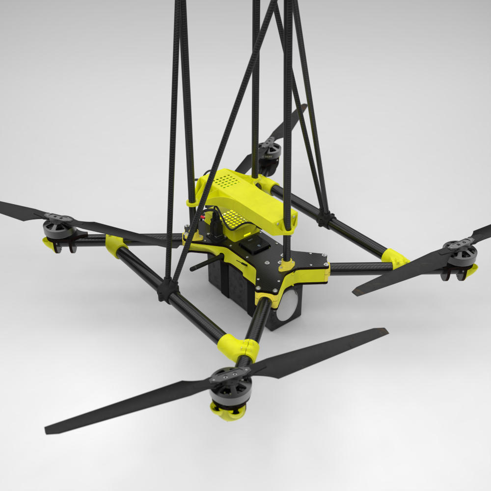
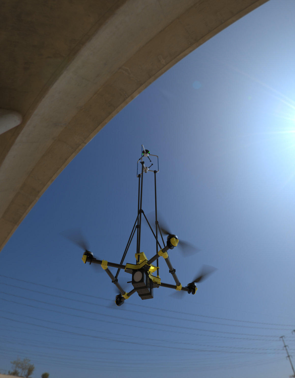
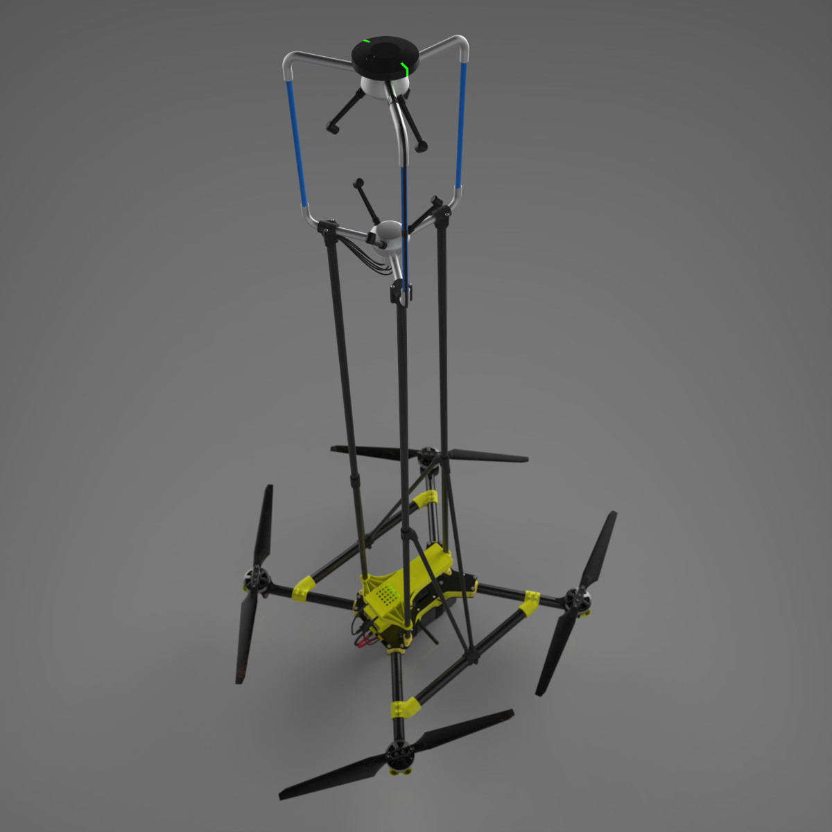
The OPTOkopter has been developed for airborne, three-dimensional wind measurements and air quality monitoring. A high-precision, 3D wind sensor is carried by a drone that was built from scratch for this purpose. The drone was optimized for long flight times and precision flight. All wind measurements werde compared with the new wind lidar system of the Physikalisch-Technische Bundesanstalt (PTB), Germany's national metrology institute. The mean deviation of the measurements was shown to be below one percent.

A RTK-GPS allows for centimeter-level accurate, automatic flights. During the wind measurements, the geometry of the environment is captured on the fly (Simultaneous Anemometry and Mapping - SAM).

Precise airflow measurements are important to understand, predict and simulate flow phenomena. Determining flow velocities is essential for:

  • Wind load and construction analysis
  • Urban climate analysis and building aerodynamics
  • Optimisation of wind farms and wind energy yield
  • Micrometeorology and gas dispersal

The OPTOkopter has been developed from scratch and is optimized for measuring flow velocities:

  • Calibrated, high-precision 3D sonic anemometer

    • True three-dimensional flow velocities
    • Uncertainties: Wind speed ± 1 % ; wind direction ± 0.5 °
    • Sample rate: 16 Hz
    • Reference ground station for wind speed

  • Optimal aerial platform

    • Perfectly stable, smooth and agile multirotor
    • Precise compensation of rotor-induced flows and platform motion
    • 45 minutes autonomy with sensor payload, quick battery swap
    • Weight: 4.9 kg, dimensions: 0.96 m ∙ 0.96 m ∙ 1.46 m
    • Wind speed up to 16 m/s, 7 Bft
    • Centimetre-level 3D positioning with RTK GPS
    • Automatic flight on 3D measurement grids
    • Optional sensors for air quality monitoring

  • Team

    • Eleven years of experience in designing and operating multirotors
    • Data evaluation by a team of metrology experts

Your contact person

Dr. William Thielicke